The Clarée valley tour (Hautes-Alpes)
Duration : 4 days
France, Southern Alps
Level : good hiker
from 600 € / p. from 4 to 8 persons
Infos & Booking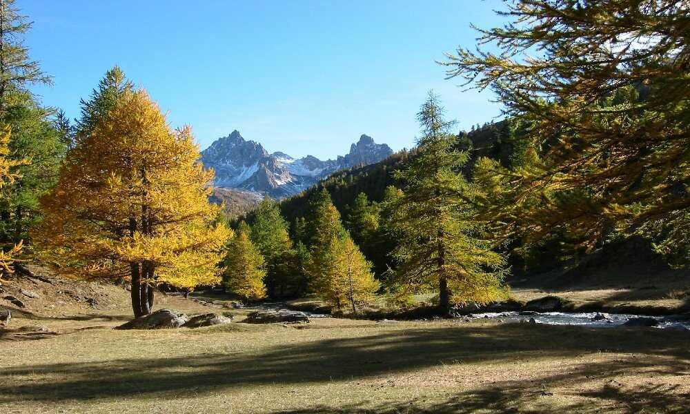
Description
I invite you to escape for four days in the mountains on this trek around the Clarée valley, one of the hidden gems of the French Alps.
This trip will allow you to explore a choice itinerary, where nature reveals itself in all its splendor. Get ready for an unforgettable adventure, combining breathtaking landscapes, cultural heritage, and authentic encounters.
Your adventure will begin as soon as you arrive in the Clarée valley, a true haven of peace nestled between the majestic Cerces and Écrins mountains. Here you will discover charming wooden chalets, witnesses to an exceptional architectural heritage, which seem straight out of a fairy tale. We will then head for the high-altitude lakes, which reflect the surrounding peaks, and you will have the opportunity to admire the diversity of flora and fauna that characterizes this wild mountain range. This will be followed by a trip to the Étroite valley, a French enclave in Italian territory, which offers breathtaking views of the immense dolomitic walls of the Cerces.
In short, the Clarée valley is undoubtedly one of my favorites in the Alps. Its wild beauty, natural riches, and cultural heritage make it a unique place for hiking enthusiasts. Whether you are an experienced hiker or a novice eager to discover the wonders of the mountains, this trip is for you. You will leave with memories engraved in your heart and the desire to return to explore even more of this sparkling valley.
I also offer several hiking trips to discover other places in the Southern Alps:
- a trekking in the Valgaudemar valley,
- the 6-day Merveilles valley tour,
- the Dévoluy massif tour between Hautes-Alpes and Drôme,
- 6 days to discover Luberon
- and the Vieux Chaillol tour in the Écrins.
Program
Day 1: Névache - Chemin de Ronde - Chardonnet hut.
Meet up and start the hike in the village of Névache, where we will leave our vehicles.
This first stage is a "sudden" foray into the high mountains.
Before tackling the hairpin bends of the Chemin de Ronde, we will discover the Clarée valley and its religious heritage: there are countless oratories and chapels.
Once we reach the Chemin de Ronde, the route is pleasant and the views breathtaking. Before crossing over to the other side of the valley where our hut is located, we can stop at the Ricou hut for refreshments.
The last part of the day is spent climbing up to the Chardonnet hut, which welcomes us for the night on its isolated mountain pasture.
Lunch: bring a picnic (not provided).
Elevation gain: 1,050 meters, elevation loss: 450 meters, distance: 13.5 km.
Day 2: Chardonnet hut - Col des Béraudes - Drayères hut.
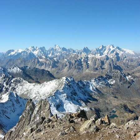
This day's hike is not particularly difficult and takes place in a rocky environment, crossing the Col des Béraudes at an altitude of almost 2,800 meters. The climb begins in vast mountain pastures where sheep graze alongside ibex perched a little higher up. Along the way, we discover the industrial and mining heritage of the Briançon region. The very end of the climb is a little technical and may require the use of the handrail provided. The pass offers breathtaking views of the remarkable landscape stretching from the Écrins massif to Mont Blanc. The azure blue Lac des Béraudes also lies at our feet.
The second part of the day is devoted to the technical descent to the bottom of the valley and the easy climb back up to the Drayères hut.
Elevation gain: 850 meters, elevation loss: 900 meters, distance: 13.5 km.
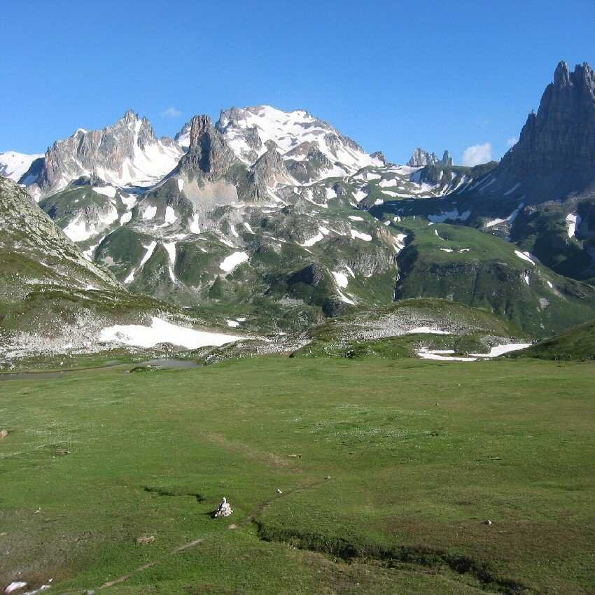
Day 3: Drayères hut - Col des Muandes - Ré Maggi hut (Étroite valley).
This day is just as alpine as the previous one and begins with the ascent of the Col des Muandes. This pass marks the boundary between the Clarée valley and the Étroite valley, and here we enter a French enclave on Italian territory.
We also discover a myriad of high-altitude lakes perched on these wild mountain pastures.
Our itinerary consists of a succession of passages on and off the trails, dominated by the dolomitic walls of the Cerces, Thabor, and Rois Mages mountains.
At the end of the day, we return to the green Étroite valley, where the Ré Maggi hut welcomes us for a well-deserved rest!
Elevation gain: 850 meters, elevation loss: 1,300 meters, distance: 16 km.
Day 4: Ré Maggi hut - Aiguille Rouge - Névache.
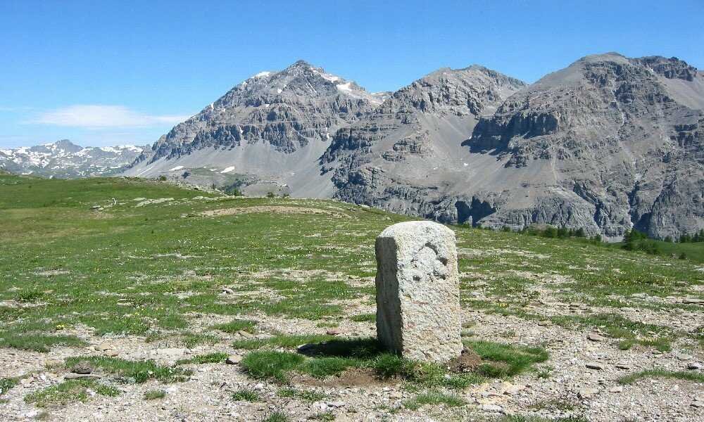
The last day of our trek allows us to enjoy the wide open spaces and bright sunshine of the Hautes-Alpes one last time. We cross the Col des Thures at an altitude of 2,200 meters, where we can see magnificent historic border markers. And how could we pass under the Aiguille Rouge without making one last ascent? A 250-meter climb separates us from the summit, but what a reward awaits us at the top!
The second part of the day is devoted to the often very hot descent on the southern slopes above Névache.
Return to the vehicles and departure.
Elevation gain: 800 meters, elevation loss: 1,000 meters, distance: 14 km.
The price includes
- Supervision by the mountain leader.
- 3 nights half board (mountain hut, nights in dormitories).
- Meals from the evening of day 1 to the afternoon of day 4 (dinners, breakfasts, picnics).
- Logistical organization of the trip.
The price does not include
- Return transport to the village of Névache, 30 minutes drive from Briançon.
- Day 1 picnic lunch.
- Personal expenses (drinks or other purchases).
- Cancellation insurance (optional).
- Anything not mentioned in "The price includes".
Accommodation
In huts (dormitories).