The Bessanèse tour (Haute-Maurienne, Piedmont)
Duration : 5 days
France, Northern Alps, Italy, Alps
Level : good hiker
from 710 € / p. from 4 to 7 persons
Infos & Booking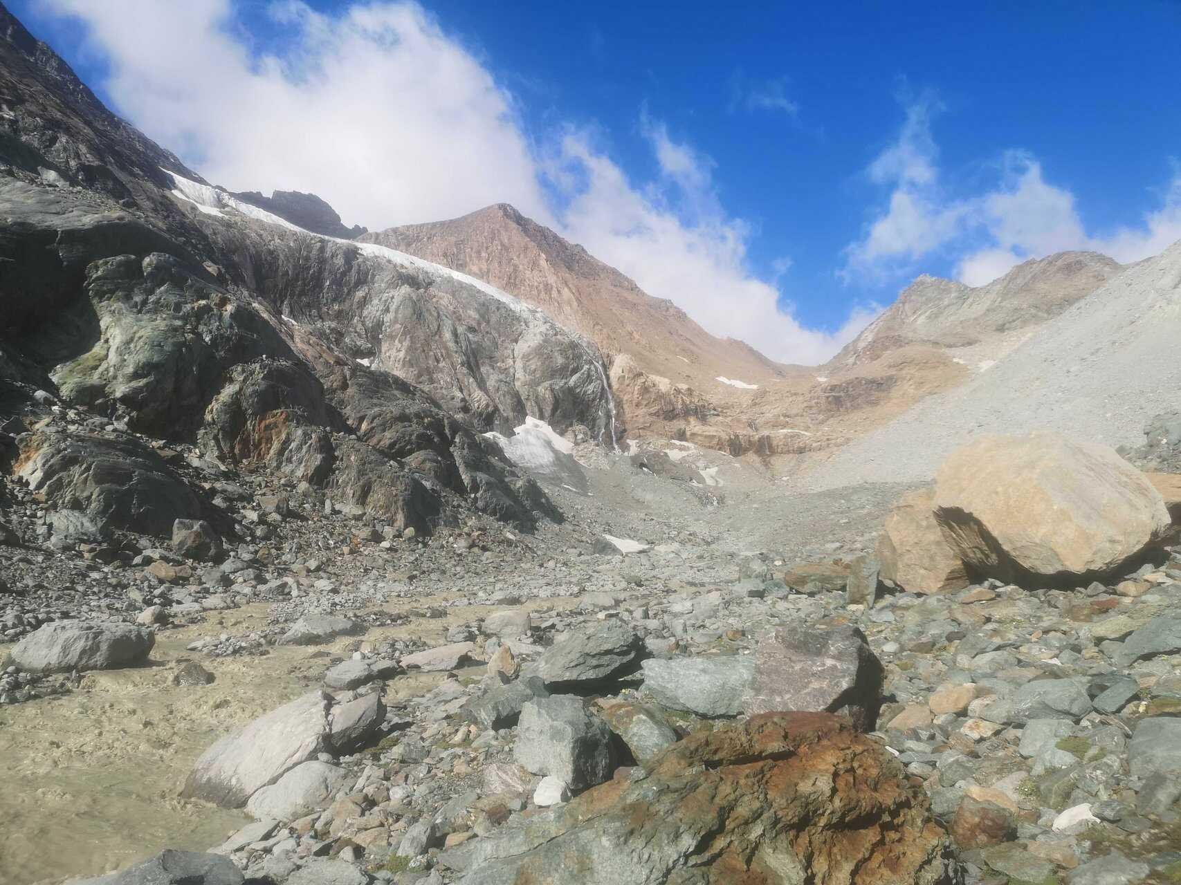
Description
Between Haute-Maurienne and the Lanzo valleys, I suggest you take a tour of the Bessanèse, along a superb route that winds its way through the foothills of the high mountains.
Reserved for experienced hikers, this trek includes several passes at over 3,000 meters above sea level, lakes, glaciers, a summit at 3,500 meters, and long, beautiful valleys that are rarely visited. The added bonus: three nights in Italian mountain huts.
If you want to hike other routes in the Alps, I also offer throughout the summer:
- 6 days of hiking in the Maïra valley and Haute Ubaye,
- the tour of Haute Clarée and its most beautiful lakes in the Hautes-Alpes,
- a hiking trip in the Dévoluy massif,
- the Haute Route of the south of the Écrins massif and
- 5 days of original hiking in Haute Clarée.
You can also go further with this mountain autonomy training taking place in the Hautes-Alpes.
Program
Day 1: Grand Fond lake.
Starting from Les Vincendières, a pretty hamlet a few kilometers from the village of Bessans, we leave the crowds of the lower valley behind and head for the rarely visited high-altitude areas. First, we reach large mountain pastures dotted with abandoned barns, then the ancient moraine and the view of the Grand Fond glacier overlooked by the peaks of the same name. A beautiful off-trail traverse along a balcony leads us to the Grand Fond glacial lake and then to the Entre Deux Ris valley, which takes us gently to the Avérole hut.
Overnight stay at Avérole hut.
Elevation gain: 1,100 meters, elevation loss: 900 meters, 5.5 hours of walking.
Day 2: Colerin pass.
Archaeological evidence shows that the Colerin pass is one of the oldest passes from Haute-Maurienne to Piedmont. Until recently, the route involved crossing glaciers on both the French and Italian sides, but glacial retreat now allows us to cross on foot. So today, we walk in the footsteps of those travelers of yesteryear, who sometimes even crossed with their livestock, in the magnificent atmosphere of the high mountains.
Overnight stay at Gastaldi hut.
Elevation gain: 1,000 meters, elevation loss: 700 meters, 6.5 hours of walking.
Day 3: Crotas, Bessanetto, and Rossa lakes.
We spend the day strolling from lake to lake to reach the Cibrario hut, our next stop. The stage is short if we take the fastest route. This gives us the opportunity to stroll around and discover a few lakes and viewpoints off the main trail. There is a wide variety of colors in the changing geology, breathtaking views of the surrounding peaks, ridge crossings above Lago della Rossa, and often ibex to be seen.
In short, a beautiful day to tailor to your fitness level and the weather.
Overnight stay at Cibrario hut.
Elevation gain: 800 meters, elevation loss: 700 meters, 5 hours of walking.
Day 4: Pera Ciaval lake and Crocce Rossa summit (3,566m).
There are few peaks of this altitude accessible to hikers in the French Alps, and almost all of them are located between Haute-Maurienne and the Lanzo valley. The climb, with a reasonable elevation gain from the hut, is fairly short but challenging. First, you have to climb a good trail to the Col de la Valette, where a steep and rocky path leads to the summit. From the top, there is an exceptional panorama of the other giants in the area, including the Vanoise, Mont Blanc, Gran Paradiso, the Po valley, and more. The list is too long! We set off early in the morning to enjoy the view and take a nap near lake Pera Ciaval on the way down.
Overnight stay at Cibrario hut.
Elevation gain: 900 meters, elevation loss: 900 meters, 5 hours of walking.
Day 5: Autaret lakes and pass, then the Lombarde valley.
This beautiful, long day takes us first to the Sulé pass, then to the Autaret lakes, nestled in a beautiful mineral setting, and the Autaret pass at an altitude of 3,072 meters, the other historic passage between the Maurienne and the Lanzo valley. We then descend the superb and very long Lombarde valley to the Avérole hut and then Les Vincendières to complete our journey.
Option of an extra night at Avérole hut to reduce the descent to 1,450 meters.
Elevation gain: 1,000 meters, elevation loss: 1,850 meters, 7.5 hours of walking.
The price includes
- Supervision by the mountain leader.
- Accommodation in a mountain huts with half board, including picnics at lunchtime.
The price does not include
- Return transport to Les Vincendières, a 2-hour drive from Chambéry or Albertville.
- Picnic lunch on day 1.
- Drinks.
- Race supplies.
- Anything not mentioned in "The price includes".
Accommodation
In mountain huts (dormitories), including 3 nights in Italy, where the huts are renowned for their dinners!